Monthly Archives: October 2015

2015.10.12 – Wind Pattern

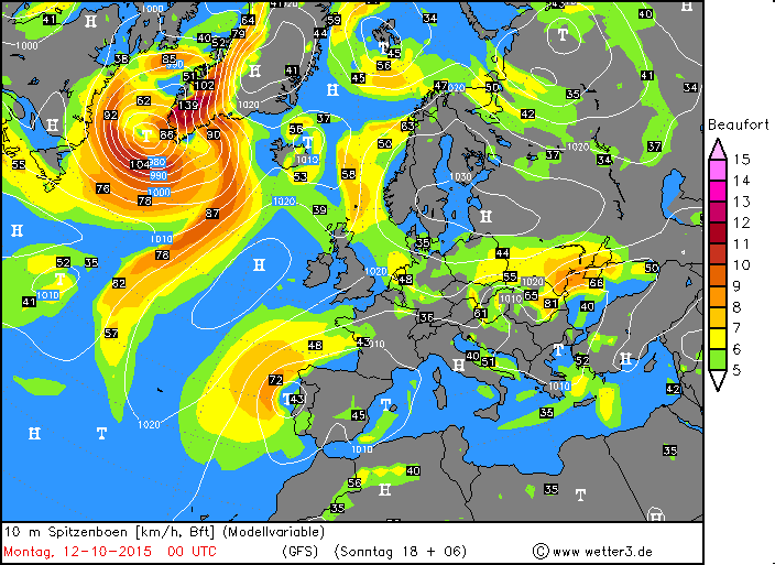
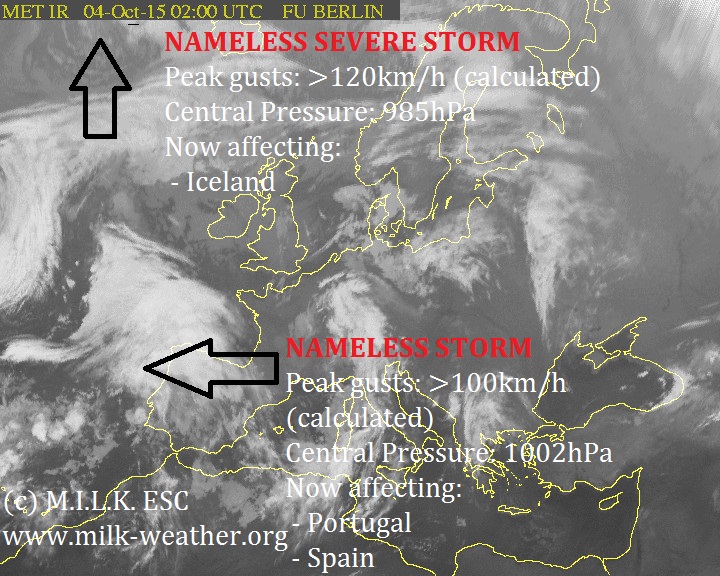
Currently there is not much activity in terms of windstorms in Europe. We have one severe storm currently lingering over the S tip of Greenland, and it will move on to affect Iceland within 24h. A severe storm warnings has therefore been issued for ICELAND. Below is the peak gust forecast from the GFS model for Europe at 00UTC today.

2015.10.12 Wind pattern

2015.10.05. – ESC Overview: Three storms in Europe, one very severe

We currently have three storms affecting W Europe. The storm in Iceland is by far the strongest – with peak gusts up to 166km/h (the value calculated by MILK ESC) and a central pressure of 968hPa this is a strong storm fairly early in the season. The storm that affected Spain and Portugal, as well as France yesterday now has a name: QUIRIN. Other than that, a third, new storm has formed in the Atlantic to the W of France. This storm is going to again bring wind to Portugal, Spain and France. Warnings have been issued.

2015.10.05 Overview 2015.10.05 Sat analysis 2015.10.05 warn

2015.10.04. – ESC Overview: Three storms, two making landfall, one severe

MILK ESC is currently tracking three storms in the region. One of the storms is currently making landfall on the Iberian peninsula with gusts up to 100km/h (calculated). A second storm is lingering in the middle of the north atlantic with peak gusts near 100km/h, but it is not forecast to make landfall within 48h. The third storm is classified as a severe storm and is currently located to the SW of Iceland, but a severe storm warning has been issued for Iceland – action will start here within 24 hours. Below is the ESC Overview.


2015.10.04 Overview 2015.10.04 Sat analysis 2015.10.04 Warnings