
Two tropical systems are currently being watched by NOAA’s National Hurricane Center – one a hurricane in the eastern Pacific, one a tropical storm in the vicinity of the Bahamas. Here are the details
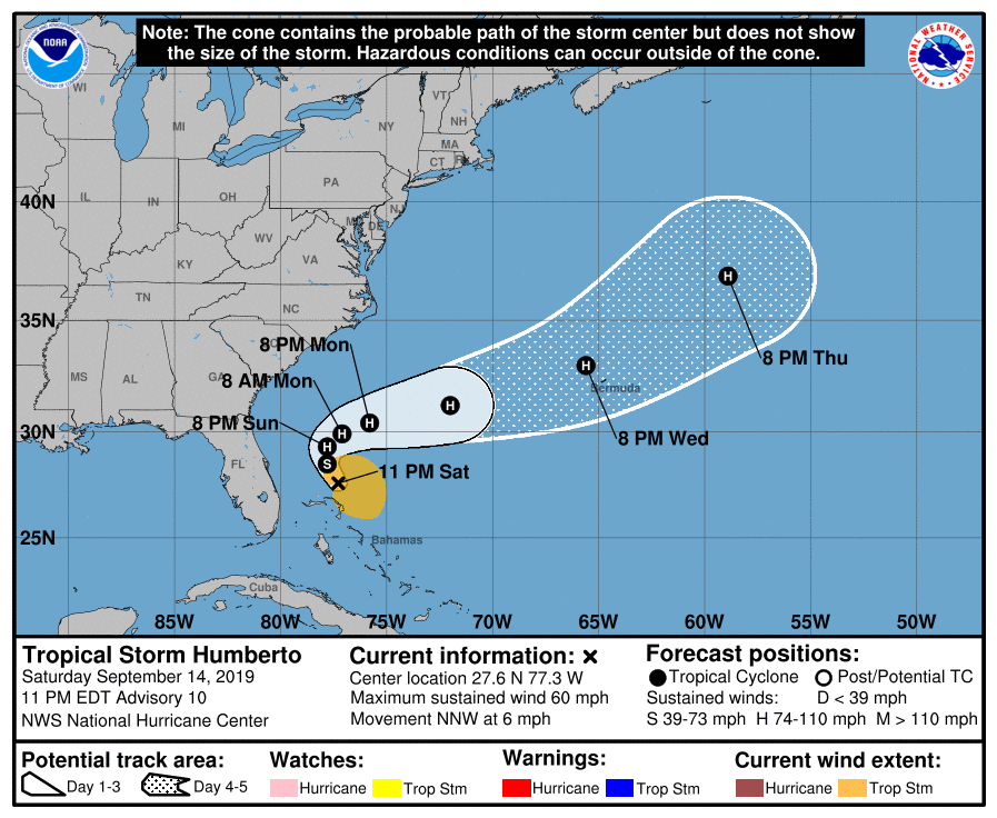
Tropical Storm Humberto
Central Pressure: 1000 hPa
Maximum sustained winds: 93 km/h
Gusts: 110 km/h
Tropical Storm Humberto is currently located just to the north of the Bahamas, its precipitation and even its storm field affecting some of the nation’s islands. It is currently not predicted to make landfall in the mainland US, instead turning back out to the Atlantic and then heading towards the Northeast. The storm is, however, still expected to strengthen and is predicted to be upgraded to a category 1 hurricane by 8pm on Monday (EDT), and a category 2 by 8pm on Tuesday (EDT). On Wednesday, the storm is expected to be positioned around Bermuda. Whether the British territory is going to be struck isn’t entirely certain yet, however, precautions should be taken.
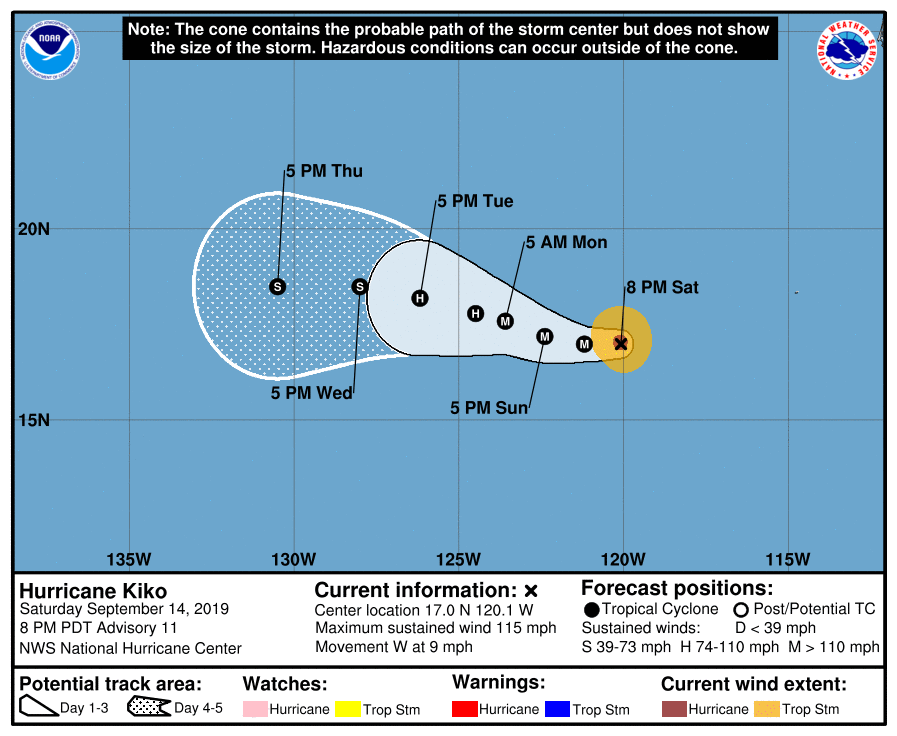
Hurricane Kiko
Central pressure: 966 hPa
Maximum sustained winds: 184 km/h
Gusts: 211 km/h
Category: 3
Hurricane Kiko, though a major storm, is located well out on the Pacific and is headed Westwards, away from land. It therefore poses no real risk to North America. The storm is expected to continue on this trajectory for the days to come, eventually weakening to a category 1 storm by the end of the 5-day forecast period.