
Forecaster: LH
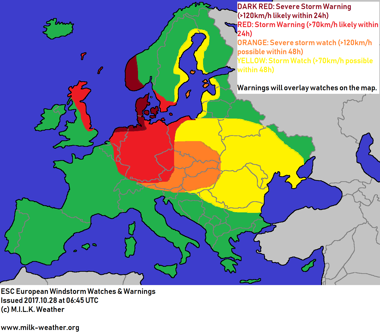
This weekend is expected to be a rather turbulent one throughout large parts of Europe. On Saturday, storm conditions persist between low pressure in the north and a high pressure system located near the British Isles, a constellation which will ultimately also allow tomorrow’s storm HERWART to form. In the near term, storm gusts and even some hurricane-forced gusts are to be expected in southwestern Norway and on the islands of the North Sea. Severe storm warnings have been issued accordingly.
As strom HERWART starts to form and move southeastwards over Scandinavia – towards mainland Europe – wind speeds will pick up. Within the time period for warnings – 24 hours (storm fields predicted between 24 and 48 hours from now are marked as “watches”) – storm gusts of over 120km/h are to be expected in Denmark as well as the German North Sea coast and the northern coast of the Netherlands. Storm gusts are to be expected throughout much of Germany, the Netherlands, the Czech Republic and Austria.
As storm HERWART will continue to move southeastwards, some of these regions may also experience severe storm gusts over 120km/h. A severe storm watch is in effect, but covered by the warning on the warnings & watches map.
The storm is then expected to move through eastern Europe later on Sunday at a rapid pace, with much of eastern Europe experiencing severe storm gusts or at least storm gusts. Watches have been issued accordingly; see the map below.